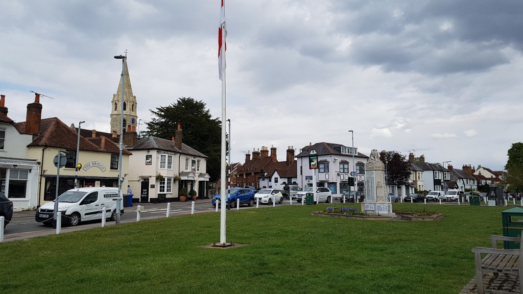
This is a walk I know well. I’ve walked it with family when the kids were small, and I’ve walked it with friends. Sometimes my eldest son accompanies me now, and sometimes I walk it alone. This time I was alone.
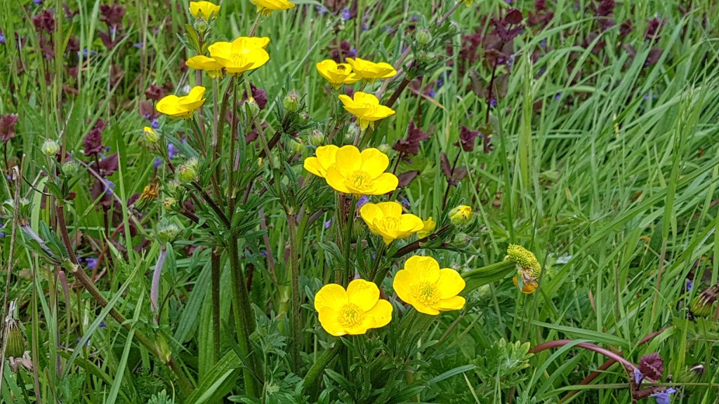
I’ve been having problems with my right foot for some time now, and I have self-diagnosed it as metatarsalgia. A couple of friends know about these things too, and my symptoms fit. I’ve bought some special pads to relieve the pressure on my foot, and a short walk was what I needed to see if it worked. The pad is a little fiddly to position right, but once right, it does help. I enjoy my walking too much to stop!
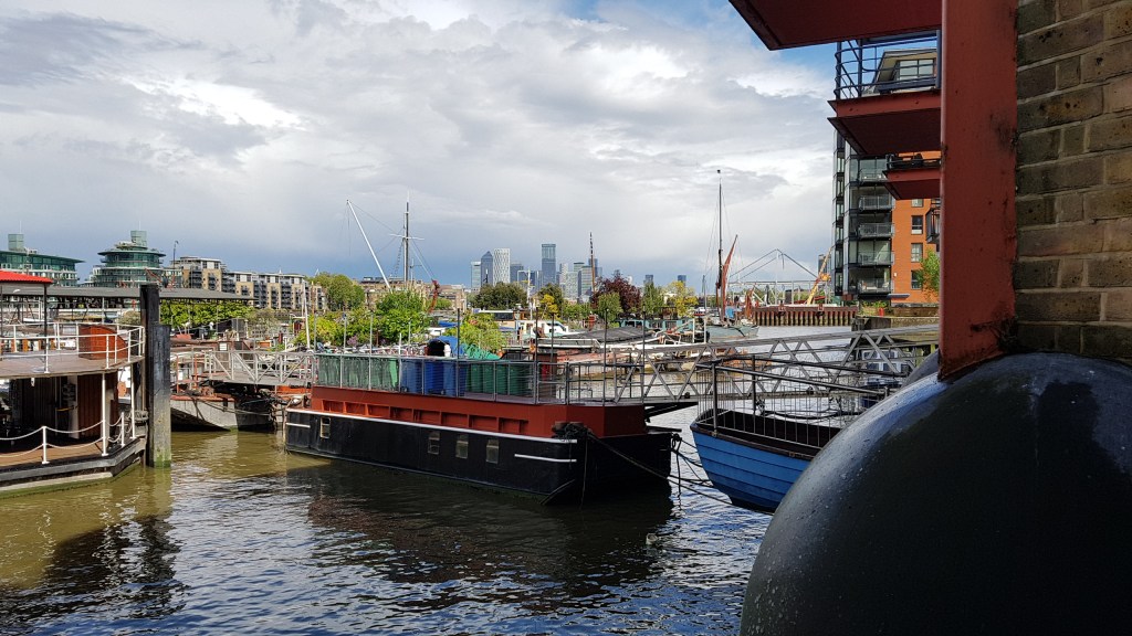
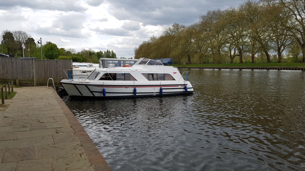
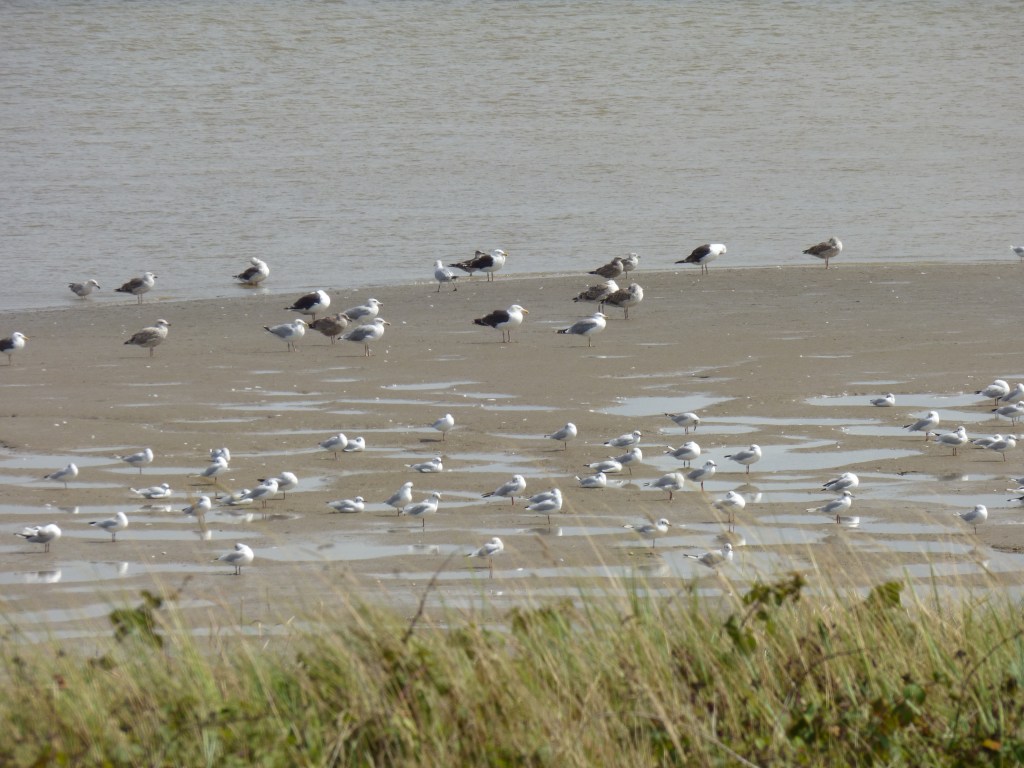
Kingston BridgeWalking down to the river at Kingston
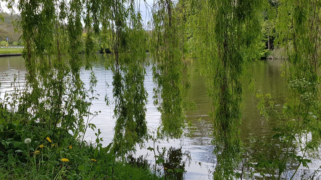
I’ve written a post about this walk before, I know, but I never tire of this stretch. Light changes like the seasons. It was good to see some green coming back after all the hot weather we’ve had.
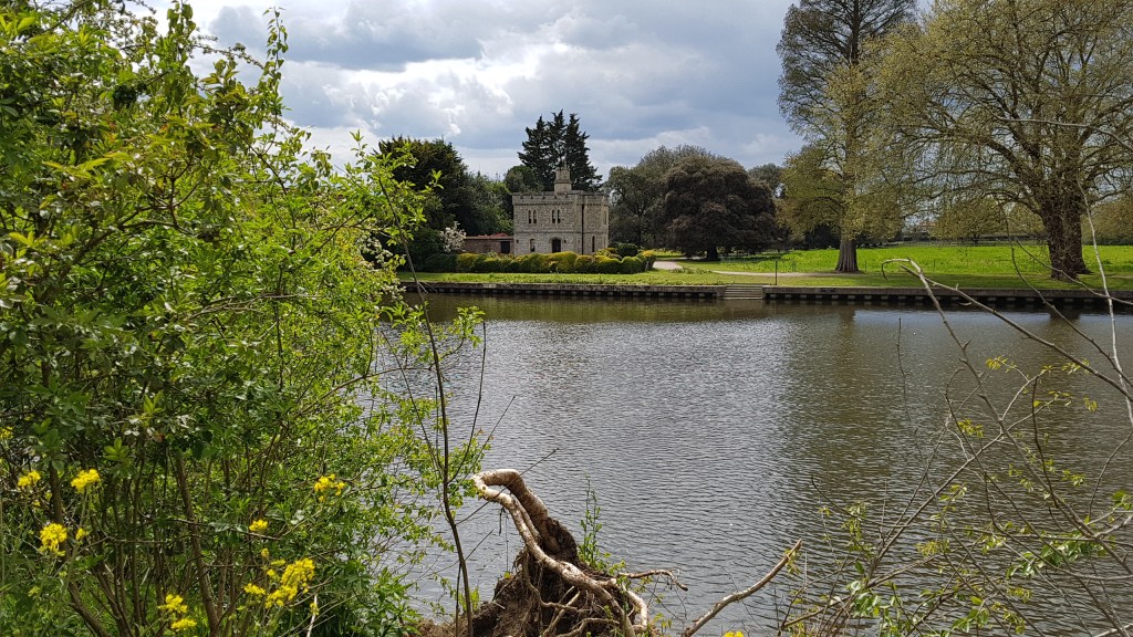
My routeTo the right of the other path is Home Park, always worth a walk through too. Often you see deer here.Hampton Court BridgeHampton Court Palace
I thought I would visit the gardens at Hampton Court Palace, but since Covid they charge around £20, whereas before Covid it was free to walk around the gardens. I had intended to use the cafe, but I’m not paying £20 just to go in. Their loss. Instead, I found a lovely cafe opposite Hampton Court station, and sat outside with a gorgeous veggie/vegan lunch.
Hampton Court Bridge looking towards Molesey LockThe cafeLunch! Tortilla with spicy beans and avocardo
The walk was successful and the metatarsal pad worked. I think I’m back in business! There are too many walks out there I want to do to give in.
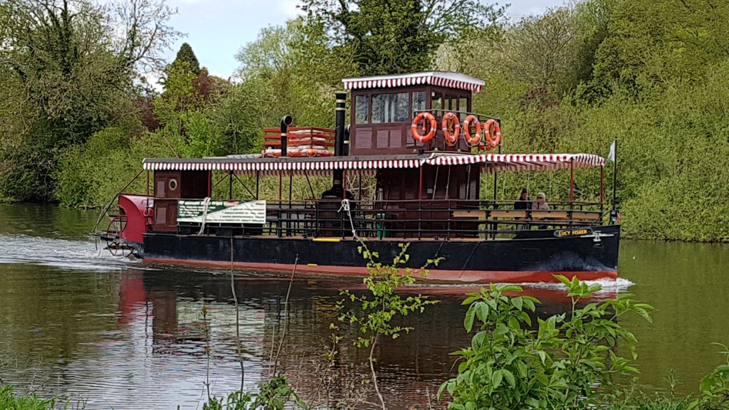
This was a day walk. Henley is around one hour on the train from Paddington. We arrived around 11.30am. The day was beautiful and warm. Close to Henley, an unsafe bridge meant a diversion through a local farmer’s property. It turned out to be a pleasant diversion, and we were soon back on Thames Path. A short walk and we were in Shiplake, where we stopped to have our packed lunch. We considered going to The Baskerville pub for a cup of tea before setting off again, and this was our big mistake. We didn’t! A regret that would live with us until Reading!
HenleyHenleyThe unsafe bridgeAcross the field on the diversionHeading back to the ThamesAcross the bridgeMapThe Boat House
The next stretch of the walk took us alongside the railway track and over the line at Shiplake Station (a station on the Twyford to Henley line), and at this point, we temporarily left the Thames. Coming back to it, we were disappointed we couldn’t see St Peter & St Paul Church through the trees. It hides up beyond Shiplake College Rowing Club. It would have meant a walk uphill, and knowing we still had a fair way to walk, we reluctantly didn’t venture up there. However, I can tell you that the poet Tennyson married here and paid the vicar with a poem instead of the fee! Also the author George Orwell grew up in Shiplake.
Damselfly – always wildlife to look out forShiplake seemed to go on forever!
This was perhaps the more interesting part of the walk and seemed well spread out.
Rather liked this door!One of the best viewsStill in Shiplake!
The next section of the walk seemed to be a slog. There were no real landmarks to tell us how far we still had to walk, or locate on the map. My map of the route was over several pages of the book, but we seemed to be stuck on one page for an eternity. At this point, we were in desperate need of a cup of tea! We were holding on for Sonning where our books said there was a riverside tea shop.
Walking into Sonning. Is that a postbox on the bridge?!This is the bridge we walked overSonning
We arrived at Sonning Lock where there should have been a tea shop. There wasn’t! The Lockkeepers said it had been closed for two years. My friend asked if they would make us a cuppa, but no. We asked how much further it was to Reading and were told it was about three miles. So we sat on a bench to eat our last snacks and drink our water. We both needed plasters for our feet, and then we set off again dreaming of cups of tea lined up on a bar!
Sonning Lock
The final slog along the Thames seemed daunting. However, it wasn’t long before signs of Reading emerged, like a school rowing club with Reading in its name! This urged us on.
Reading School Rowing Club out on the water
We pressed on as we saw tall building through the trees. We could also taste the tea!
On the outskirts of ReadingDespite being tea deprived, I stopped to take this!Very close nowCaversham Lock
By the time we reached Caversham Lock, I knew we were close to Reading. We came to a part in the path I remembered from a previous trip to Reading. For a moment, we came off the path and headed for the big Tesco store because they would have a cafe. Our spirits plummeted again when we found the cafe was closed due to lack of staff. Dispirited, we used the customer loos and headed back to the path.
Finally, we saw Reading Bridge. We were there. And the station was just over the road. We finally got our cuppa. Pure nectar!
Reading Bridge
After we recovered, we headed for the train. Our plan had been to use the new Elizabeth Line back into London, and this we did. As I have Freedom Pass, I was able to ride this for free! Nice to have some advantages to getting older! It took around an hour. The fast train probably takes half that time, but this was our dream to ride the Elizabeth Line. I’ve followed every development of Crossrail, now the Elizabeth Line, and this was a good opportunity to travel a whole length of it. The train was less crowded than the fast train (which we saw flying past!). It was a nice relaxing ride back to London.
Happy to be on the Elizabeth LineInterior of train – not that busy from Reading
Door to door we had walked just under thirteen and half miles, the longest Thames Path walk we’d done. Each section of the path is different. There are boring bits and beautiful parts. We were just glad to reach the end this time. We have our next walk planned, but due to National Rail going on strike, we have already had to change the date. Whether it happens remains to be seen. I have walked this next section before when staying in Reading. It seemed a long walk last time, but it says in our books the walk is seven miles. It should be a doddle after what we’d just walked!
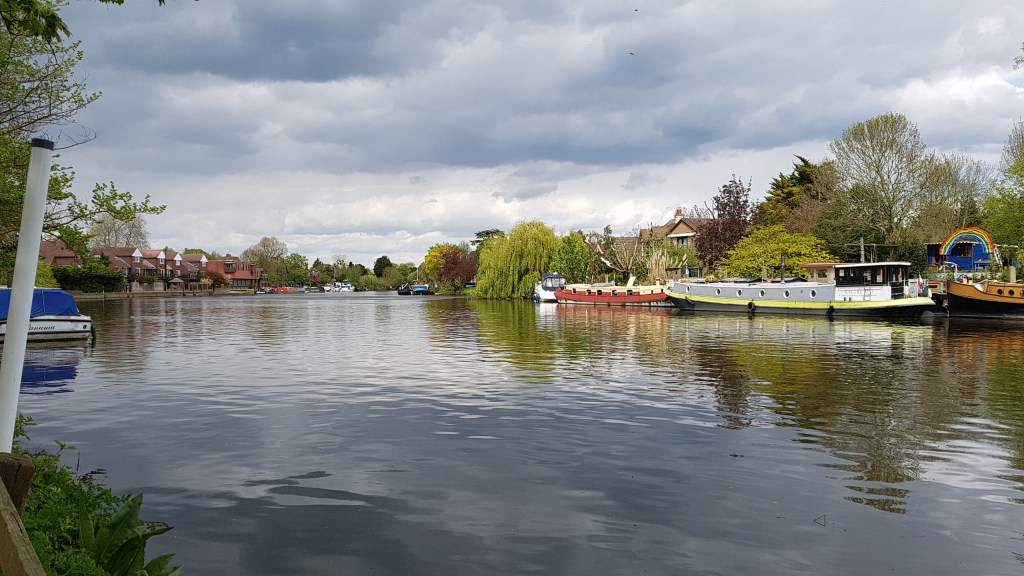
The weather here last week was dreadful. That and a tube strike in London on two days meant I had to change my plans both days and meet friends where we could both reach either by national rail or bus. That place ended up as Richmond.
The first visit was on the Tuesday. It was raining when I left home. My telescopic umbrella refused to go all the way up, so there I was trying to get my arms into a waterproof while walking to the station with my rucksack. I was not happy! Luckily, by the time I reached Richmond, the rain had almost stopped, and then it did.
Richmond footbridge
We chose a short route from Richmond Bridge to Kew Bridge. It was a lovely walk, despite the overcast sky and the threat of more rain. A little way along, we encountered a path with a lot of puddles and lots of mud. It was a case of walking around the edges and trying not to get a foot full of water or mud.
Old Deer Park
This is a particularly nice walk as you have Old Deer Park (no deer!) on the right with a stream, and the Thames on your left. To the right, across the river is Syon House and Park. You can see both the boathouse and the house itself. The painter, J.M.W. Turner, rented a house nearby and painted scenes of the Thames.
Lots of gulls aroundOld IsleworthThe pink Pavilion is the boathouse in Syon ParkKew BridgeKew
At Kew we came off the path, eager to find somewhere to eat. The Cricketers was all we hoped and more. The staff were friendly, the pub had atmosphere, and the food was excellent. We lingered a long time over lunch and splashed out on a second cup of tea. We know how to live!
We decided to walk back the same way, as Richmond has more transport links. Gradually, the drizzle returned and then became heavier. At least most of the walk had been rain-free.
Syon HouseKew Observatory in the background. I am told the Obelisk is the old meridian line
My second visit was on Thursday. This was a lunchtime meet in a cafe with a friend combined with a ‘free-write’ session. In my other life, I write short fiction and poetry.
Afterwards, we took a brief look at the river. The water had flowed over the banks in places, due to all the rain, and possibly a high tide. I believe I am right in saying that the River Thames becomes a tidal river from Teddington.
Heron Court, Richmond
A view from Richmond BridgeThe Tide is High as Blondie would say”!
So, there we have it. Richmond has very pretty walks, and is close to Richmond Park. I wrote not long ago about a walk I took through the park, down Richmond Hill to meet the Thames. I am lucky to live close to such lovely and interesting walks.
Near St Saviour’s Dock where Dickens set scenes from Oliver Twist
(1) Tower Bridge to Greenwich (south bank)
It was a crisp (okay freezing) day, but the sun was out, when I met a friend at London Bridge for our walk along the Thames Path. Although I have walked this section before, it’s amazing how much I’d forgotten. Well, it was several years ago when I last walked it.
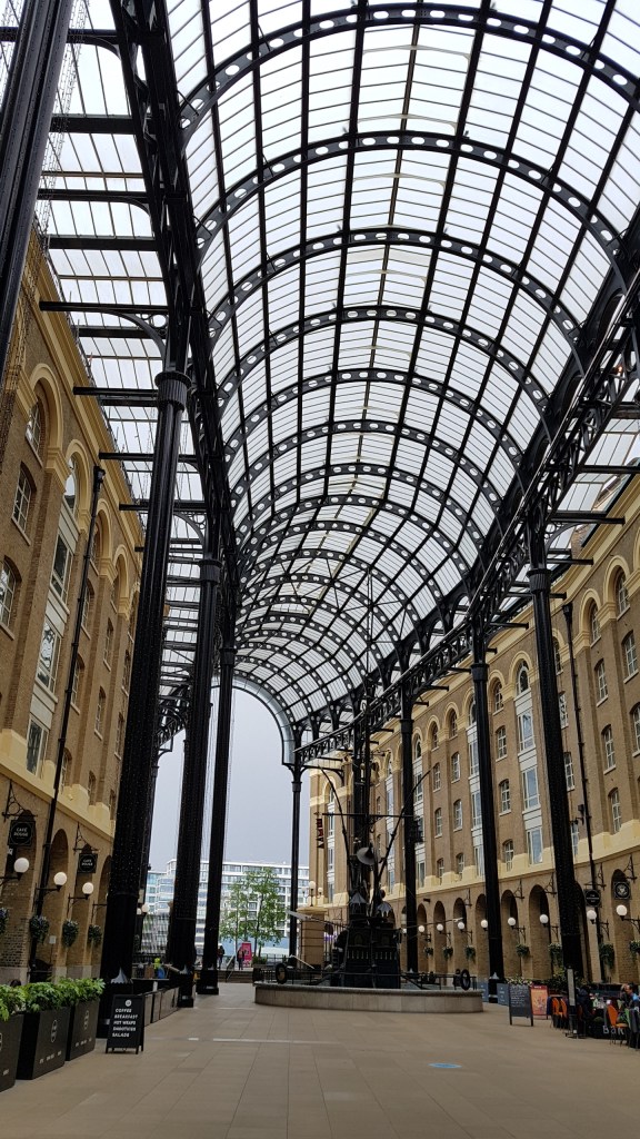
We walked through Hays Galleria to join up with the Thames Path where we had to go carefully in the beginning as the frost hadn’t all melted. The smooth paving slabs were slippery and we both almost fell over. We picked our way through, choosing drier patches or rougher slabs until eventually walking became easier. I love walking along Shad Thames where the old warehouses have been converted into apartments, their walkways crossing the path above you and festooned with plants and flowers. I failed to take as many photos as usual, so please have a look at this website for some great information and photos to do this walk justice. There are some stunning shots and a handy map.
Just off the path is a square with a lovely fountain, the edges of which have little bronzes (maybe bronzes…frankly it’s a guess!) of a camera, a notebook, a pen etc. There is also a handy cafe here if you need a warm up.
Back on the on the path we next encounter Dr Salter. His statue, and that of his wife, his daughter and cat all occupy this little park. Dr Salter did much for the poor in Rotherhithe, only to lose his own daughter, Joyce, to scarlet fever. Read all about it here at the excellent Look Up London website (who run fantastic walks too).
Surrey Quays
Cloud covered the sun as we walked further. All along the route there were little gardens with benches which, in better weather, make a nice resting place. The path occasionally takes you off the Thames where new apartments now stand, but you never away from the river for long, nor far from it.
A good stopping place in spring would be Surrey Docks Farm. Only the cafe was open last week, and they stressed there were no toilet facilities (these are in the farm which as I said was not open). Please see the website for opening times. I have been in before, and it is delightful and really worth a visit.
In Deptford there used to be docks from where James Cook set out to discover Australia. But other famous names are associated with these docks too. Have a read of this short article and this excellent website talks about the connection of John Evelyn and Samuel Pepys to the docks.
All that is left of the original docks are these stone pillars.
Walking out of Pepys Park we came across a mile post. It’s not often one sees these type with long distances recorded. I was wondering how one got to Dover from here, but I no doubt there is a pathway somewhere as you head out to Kent where you leave the Thames Path and join another pathway to Dover. Oxford, of course, is on the Thames Path, one of many sections I have not yet walked.
Distance (mile) post
Now it was possible to see Greenwich in the distance. At some point on the walk I had changed my socks because my original pair were chaffing. I believe they were too loose so that my foot was sliding in them. It is always a good idea to have spare socks (and plasters) on long walks! The change helped, but it was good to know we weren’t far off our main stop.
Greenwich in the distance. The tide was in and lapping the wall. It was like being at the seaside if you closed your eyes.
The sun was out again, and our thoughts turned to food and toilets! For lunch we found The Old Brewery where we had a most excellent soup in wonderful surroundings (see photos). It was a chance to sit and recover. We talked about walking on to the Thames Barrier, our original destination, but having studied the map (and knowing there was a long haul around the O2) we decided to end our walk in Greenwich. Besides which, I don’t think our legs were quite up to another three to four miles. We’d walked near on eight miles already. That was enough.
The Old BreweryThe Old Brewery, Greenwich
From Greenwich it is an easy journey back into London using the DLR and changing at Canary Wharf to the Jubilee Line.
If you enjoyed this, do take a look at a walk I took in 2014 – a circular walk from London Bridge to Tower Bridge incorporating both sides of the River Thames with a couple of stops to view inside churches. You can read it here.
The Cutty Sark, Greenwich
(2) Putney Bridge to Hammersmith Bridge
Putney Bridge
I was meeting a friend in Hammersmith and decided to take the bus to Putney and walk there along the Thames. The day was brilliant, but freezing (again). I know this section well, as I have walked along it many times, as well as having visited Fulham Football Club, which sits along the edge of Thames. My youngest son has a season ticket to Fulham but got me and my other son tickets when Spurs were playing Fulham. So we were there on the same day, but he was in the home end and we were in the away end. It was too far across to see him and wave!
Fulham Palace and its gardens sit to the right of the path. Always a delight to visit if you have time. The house is interesting, and it is easy to get lost in the gardens, or maybe that’s just me! Along the Thames Path is Bishops Park Riverside Walk, another lovely diversion. The gardens have a lake with a pretty bridge and lots of wildfowl can always been seen. There is a children’s area and huge sand pit.
On Putney BridgeTaken from Putney BridgeMap of the walk
Below is one of my favourite parts of the walk. I love to see the trees, winter or summer, hang over the path. It reminds me a little of the walk along Chelsea Embankment.
BeautifulThe gardens along Bishops Park Riverside
The walk to Hammersmith takes a little over half an hour, depending on the speed you walk. I had to speed up as I realised I was going to be late! Soon I could see Hammersmith Bridge in the distance. The bridge has been closed for a long time due to structural defects. It is now open to pedestrians and cyclists. This is the second long term closure to traffic I remember. I do hope this time whatever they do works this time. However, these bridges were not meant to carry the volume or weight of traffic they now do.
Hammersmith Bridge in the backgroundI have reached my destination!
This was one of the nicest walks along the Thames Path. It was simple, so even I couldn’t get lost! I caught the train out to Windsor and walked over the bridge that leads to Eton and joined the path which begins again off a side road. Windsor goes out a long way as soon, on the other side of the bank, I saw Windsor Racecourse. Perhaps due to the way the river bends I walked a long way before I left the racecourse behind. This stretch (Windsor to Maidenhead) is around six and half to seven miles. An easy walk.
Duck Tours, Windsor. Apologies for the blurry snap, but I only had my mobile with me and it doesn’t take well to zooming in.
The path is combination of tree covered and open spaces. At first there were plenty of benches on which to sit, but it was too early for me to stop for my lunch. Later I found it hard finding somewhere to stop. In the end, I came across a willow on the bank which had a nice clearing on which to sit. I was almost toes in the water! Later I realised that I had stopped opposite Dorney Reach Hotel. Rivercraft moved up and down causing lovely ripples.
Canal boatWindsor Racecourse opposite
My first stop was close to Boveney Lock. Boveney Church has origins going back to the twelfth century. The church, built for bargemen doing trade along here, is right on the path, well as slight detour. A path leads to it from the main path.
Boveney ChurchInside Boveney Church looking towards the altarBoveney Church towards the back (note Font)
I had set off at a reasonable pace on this walk, but I slowed down as I could see that I would be in Maidenhead earlier than I had anticipated. For a long while I had the river on one side of me and Eton College rowing lake on the other.
Part of Eton College? Dorney Rach rowing lakeBoveney Lock
My other stop was by Bray Lock where I sat watching boats passing through while I ate a cereal bar. The sun had come out and I had strip off my fleece and put my sunglasses on!
Bray Lock
I wasn’t far from my destination now, about three miles. I felt so good I thought maybe I could do another section after this (though I’d already bought my train ticket home from Maidenhead). However, shortly after this my legs began to ache! I know my limits really!
One of the most lovely sections then came. Here was a gate that led through a section with private houses on the right and their moorings on the left. Only pedestrians are allowed through here. Cyclist have to follow a different path. The houses are stunning and some moorings had benches with a view! What a lovely place to live. Further along as I neared Maidenhead I saw the family home of Olympic swimmer Tom Dean, The flags were still up!
The private path – houses one side, river the other (looking back towards Windsor)Another view – towards Maidenhead
In front of me I could now see Maidenhead bridge, but before it the railway bridge. I was on the final stretch. I walked over the bridge and was immediately assaulted by the noise of traffic and so many roads. The Thames side cafe was closed for renovations and I was dying for a cup of tea. I crossed over to Bridge Gardens and sat for a while watching the Thames. Then it was time to head into town for that cuppa!
The railway bridge and behind it Maidenhead bridgeMaidenhead Bridge
The main road, maybe a bypass, was busy and the walk into town is a fair way. On the right I came across some lovely almshouses, but I bet when they were built they didn’t have a busy road and subway running so close to them.
Almshouses right up close to the bypassThis part of town reminds me of Reading
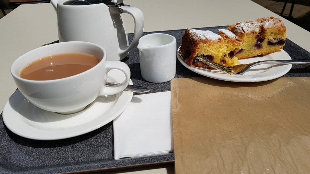
The town itself was fairly quite and I was surprised. I had a wander around before stopping at a cafe and sat outside with tea and carrot cake. Then it was time to leave. I headed to the station and had timed it well. Only about ten minutes before my train was due. This time I was going home via a different route back to London. I was heading into Paddington. When I arrived in London the tube I wanted was suspended, but I found another route across London to get home. That’s the good thing about London, there is always another way!
The reward!
Here are a few more river and town photos.
The scary bridge! I hated going under this. Every time something crossed, there was banging and clanging!Dorney Reach Hotel. I sat opposite to eat my lunchClose to WindsorA peaceful stretch of the ThamesPossibly half way through the walkIn Bridge Gardens, MaidenheadMaidenhead
Today in England more Covid restrictions were lifted. Now we can eat/drink inside cafe’s and restaurants. Museums and art galleries are once more open, or will be opening in the next few days. A friend and I had arranged to walk somewhere in London today, but the weather this month has been pretty rainy. So we decided that somewhere around London Bridge would give us more places to dive into when the showers came. This worked well.
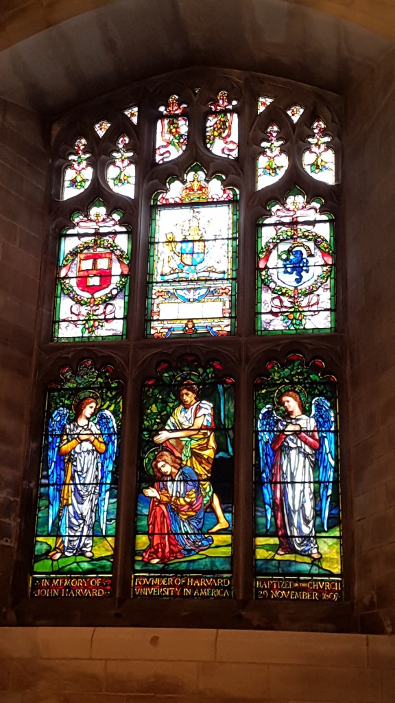
First off, we walked to Southwark Cathedral for a quick amble round before heading to their cafe for lunch and a good chat. We sat outside because we hit a sunny interval. It was so warm we took off our jackets. However, we had to dive inside with our cups of tea when a cloud burst arrived.
Harvard Chapel, Southwark Cathedral
There goes the diet! (Note takeaway bag. I took half home)
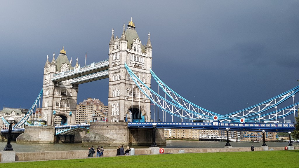
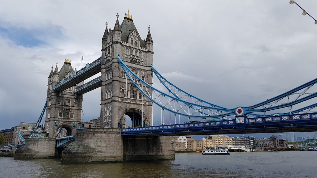
We then took a chance and walked towards Hays Galleria, yet we had to dive under cover in London Bridge station for a few minutes before we made it. I spotted a book shop (Riverside Bookshop). I’d not come across this one before so it warranted a look. Of course I found a book to buy, as you do (well, at least me!). We walked through the Galleria and out to the Thames and walked to Tower Bridge and onwards to the edges of Bermondsey to where the River Neckinger meets the Thames. Behind us the clouds were gathering for a storm, so we headed back and took shelter at One Tower Bridge. Thank goodness we made it, as it really was a cloud burst, with thunder and lightning. The photo above was taken shortly after the storm.
Hays Galleria
Tower Bridge
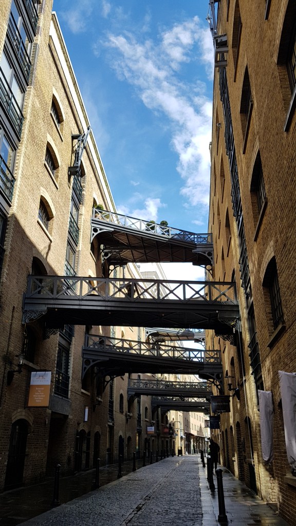
Shad Thames
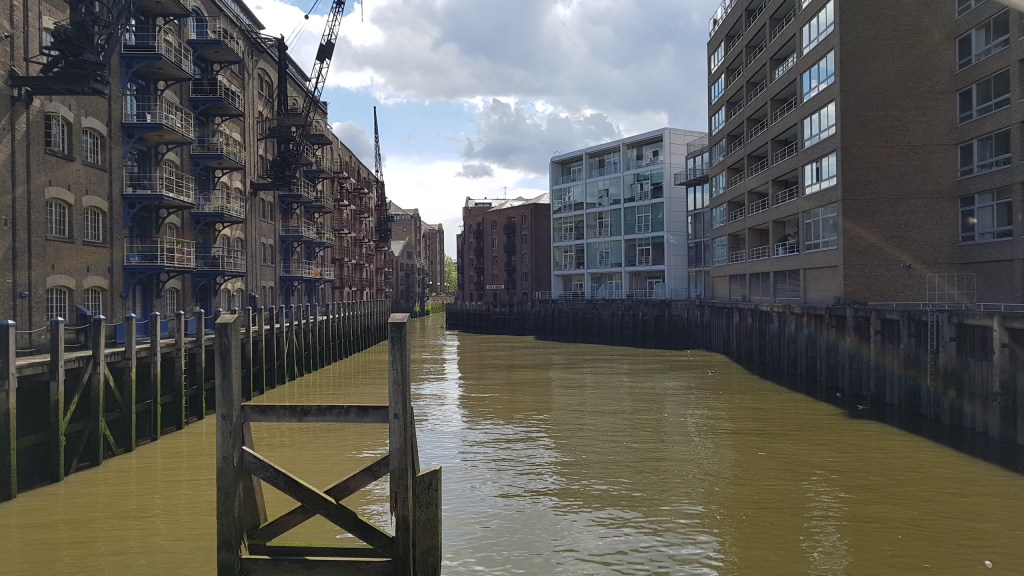
Neckinger River (the River Thames is behind me)Bermondsey
After the storm
It was getting late so we headed back to London Bridge where we went our separate ways. This is just a short part of the Thames Path (south side). There are lots of things to see. I particularly like Shad Thames where the warehouses used to be. Here, in the past, men would come to the gates each morning to see if they could get work for half a day. The area was regenerated some years ago and the warehouses converted into apartments and shops. I’d love to look inside one of the apartments, but unless you have a few million, you won’t get to buy one!
It was a lovely walk today, despite the weather. It good to be back in London again. I’m sure I will be back again very soon.
Friday was the ideal day for walking this section of the Thames Path. The weather was warm and the sun was out most of the time. Technically, none of this walk is in London, but it does begin very close to the outer reaches of London! And what would a blog about London be without those days away to places that can be reached from London? It takes under an hour to reach the start of this walk by train from central London.
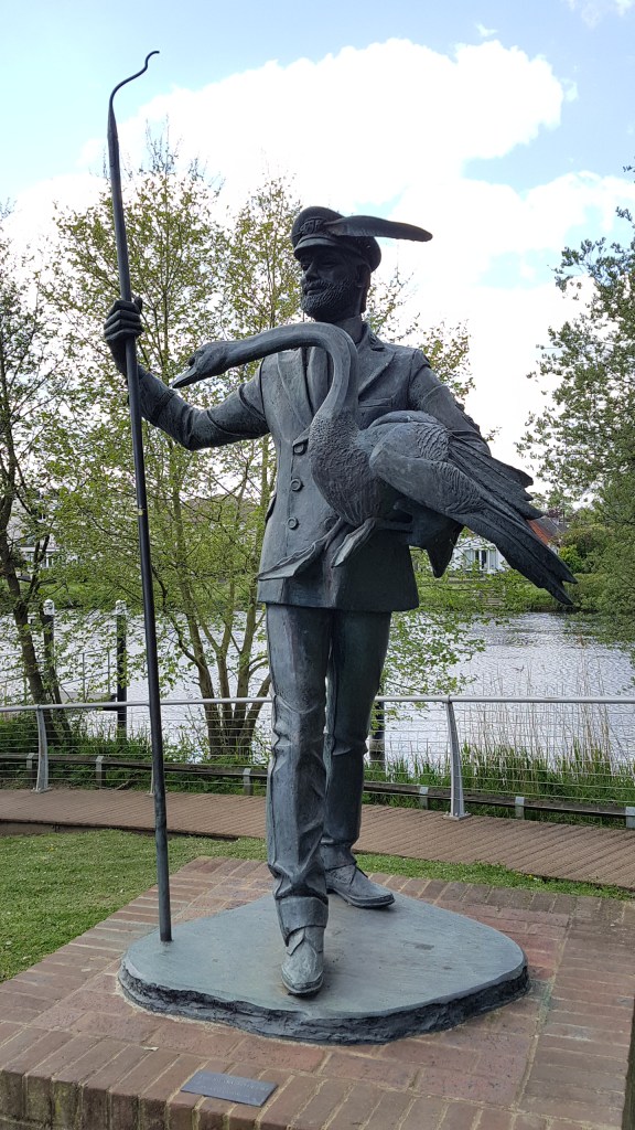
The Swam Master, Staines
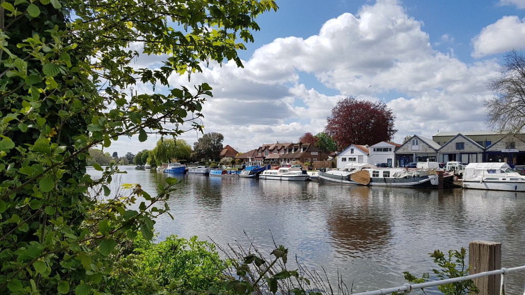
Staines (the ‘upon-Thames’ was added a few years back) was the stopping point from the last Thames Path walk taken a couple of years ago. I am not one for walking great sections in one go, like Ramblers groups or those keen Thames Path walkers who think nothing of pounding out twelve to fourteen miles in one day. No, I am the ambler not the rambler! I like to take my time, stop in places if I want, take lots of photos, and take in the scenery. I tend to break the walks down into two or three separate walks. My legs would not manage twelve miles these days anyway!
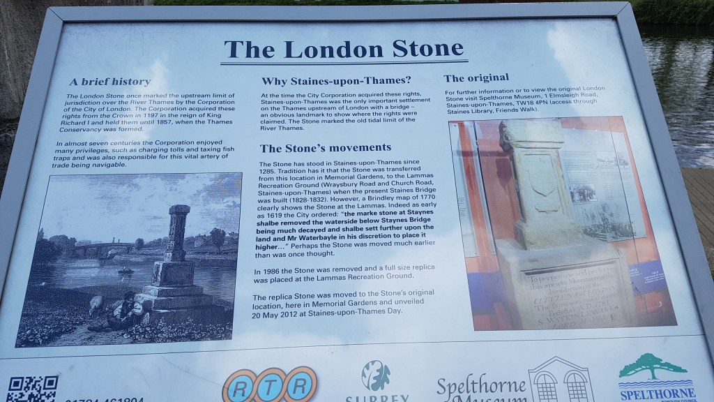
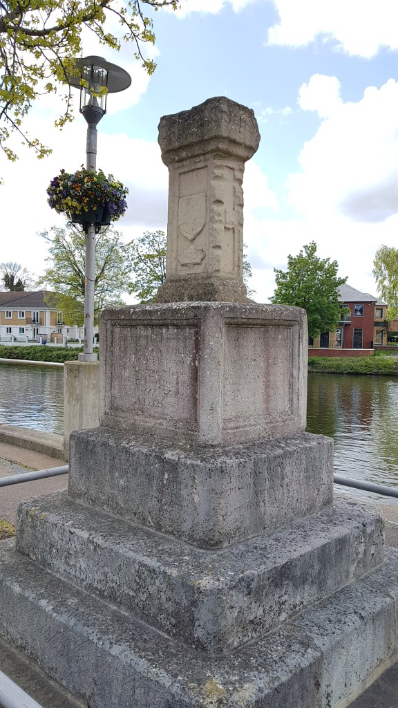
The London Stone
This section of the walk is around six and quarter miles. However, by not reading the map properly and crossing the Thames at Staines bridge like I should, I managed to add a quarter to half mile extra by staying on the same side until the path ran out. I ended up walking along a main road. I then found a footpath declaring it led to Runnymede Bridge. The path led to the river, but it was dead end. Having met someone on retracing my steps I was able to take a less worn path up to the bridge and cross it (alongside the busy M25) and scoot over the barrier and down a steep path to re-join the Thames Path where I should have been walking. I doubled back to see what I had missed on this side (worth the effort), before turning around and continuing to my destination.
Taken in Lammas Recreational Ground from my off-route walking! See that bridge over there? That’s where I should have been walking!
Had I stuck to my route I’d not have come across this.
Staines has been a crossing point since Roman times and was mentioned in the Doomsday Book as property being held by Westminster Abbey. If you would like to read more of about the history of Staines, see here.
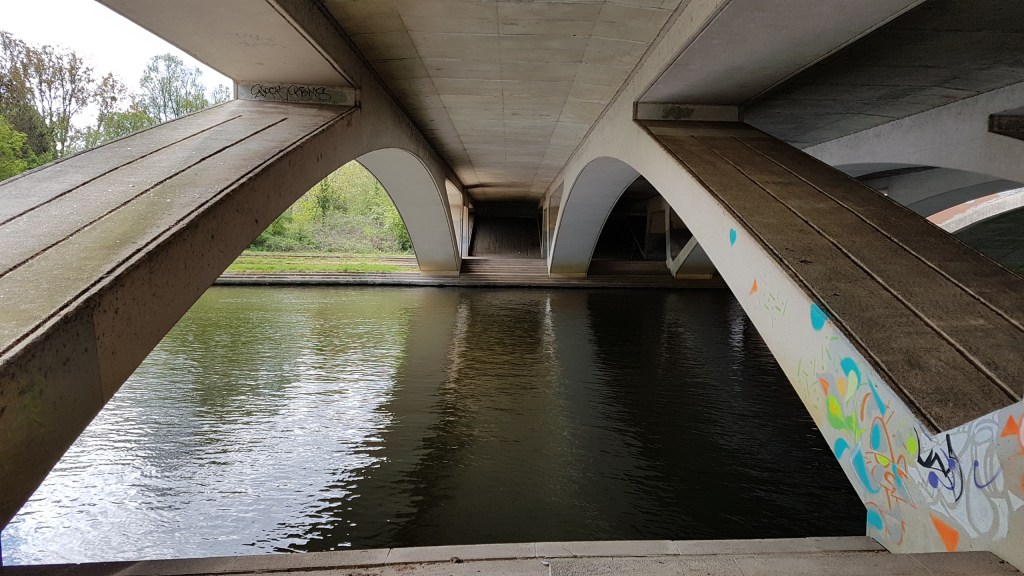
Underneath Runnymede Bridge looking towards where I should be!
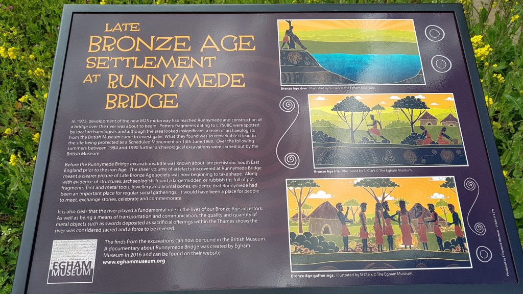
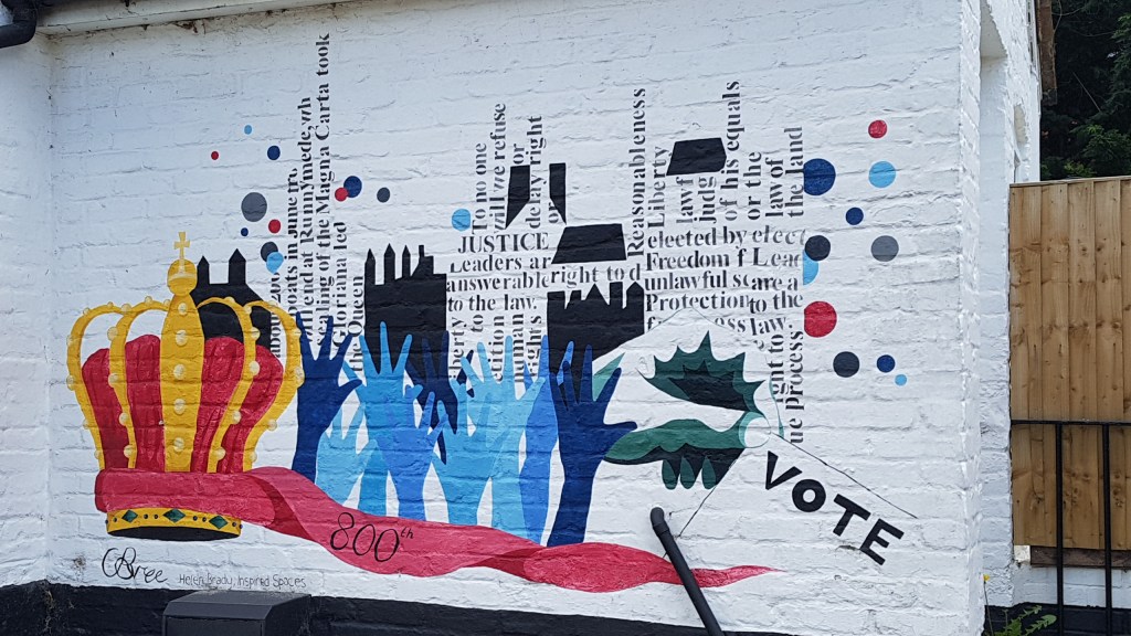
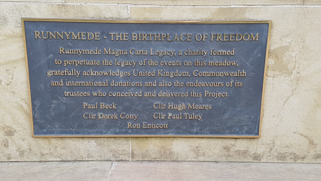
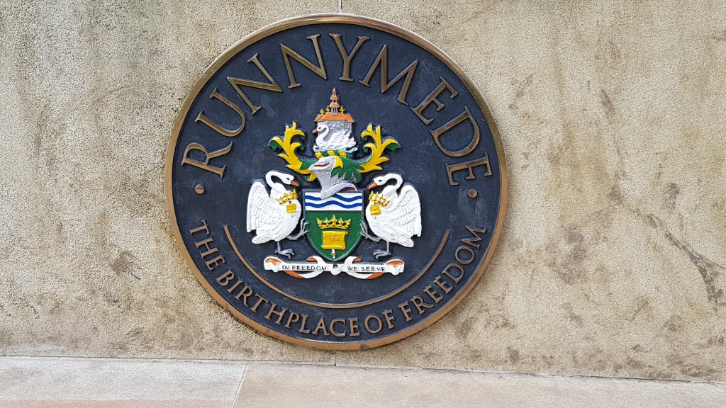
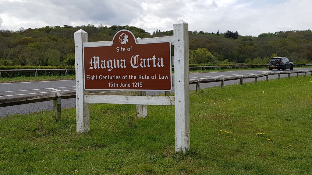
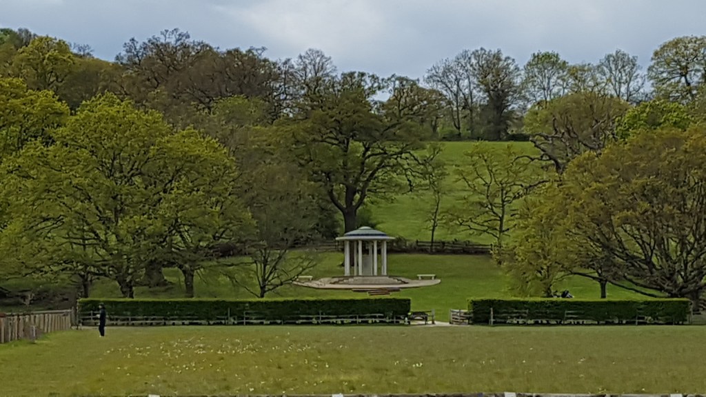
Runnymede is the home of many things. Perhaps the most famous being where the Magna Carta was signed on 12th June 1215. This was the royal charter of rights agreed to and signed by King John (though his heart wasn’t in it!) There is a monument nearby commemorating the signing. Last year my husband and I visited the RAF Memorial at Runnymede, and though we saw the memorial to John F Kennedy and other memorials, we missed the one to the Magna Carta! However, on my walk on Friday I saw it across the fields. If you read my blog from last year you will see there are statues in Lalham (nearest station to the site) connected with the Magna Carta that I took photos of.
So green – RunnymedeNow on the right path I found other fascinating things
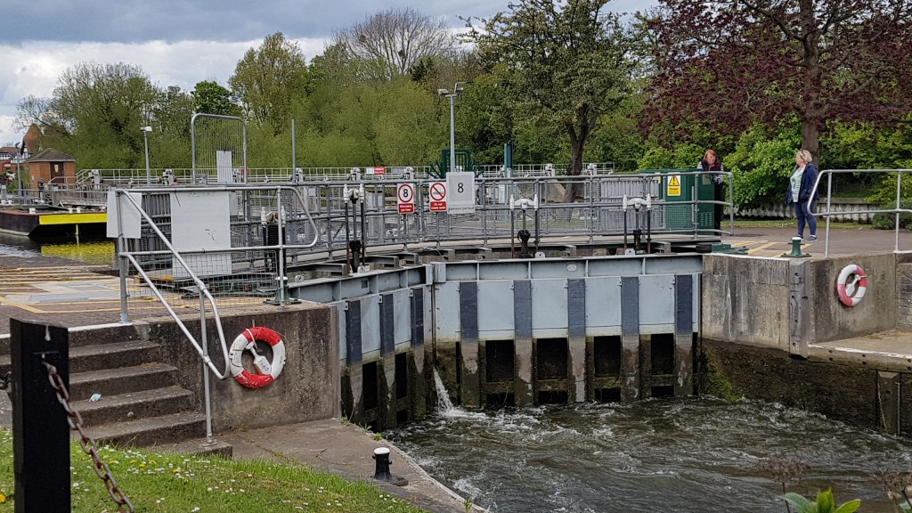
I continued my walk. The next main point of interest is Bell Weir Lock. The wall of the pub has been artistically painted with references to the Magna Carta
Pub wallBell Weir Lock
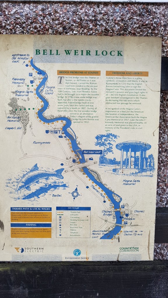
Thames map
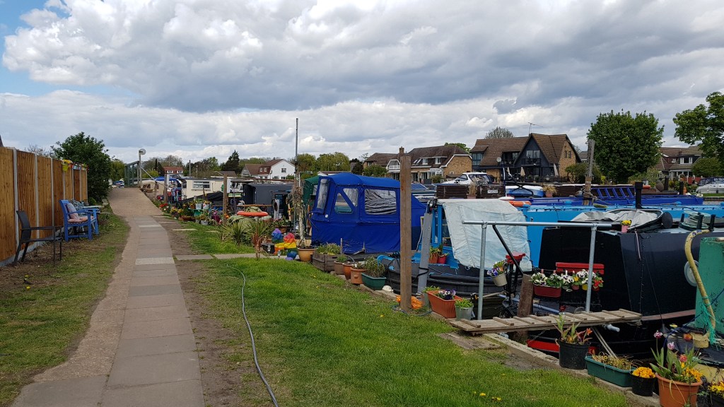
From here it is a walk to Runnymede (as mentioned above) first passing a boatyard and some pretty houseboats where tables and chairs are set out.
Houseboats next to the boatyard
In the car park at Runnymede
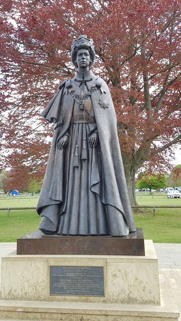
The day I was walking there was some sort of run going on. Further up I came across their refreshment stop. Runners were refueling before setting off again. Along this stretch, the river is on my right and the busy road to my left. Across the road is where the monument to the Magna Carta is (see photo below).
Monument to the Magna Carta
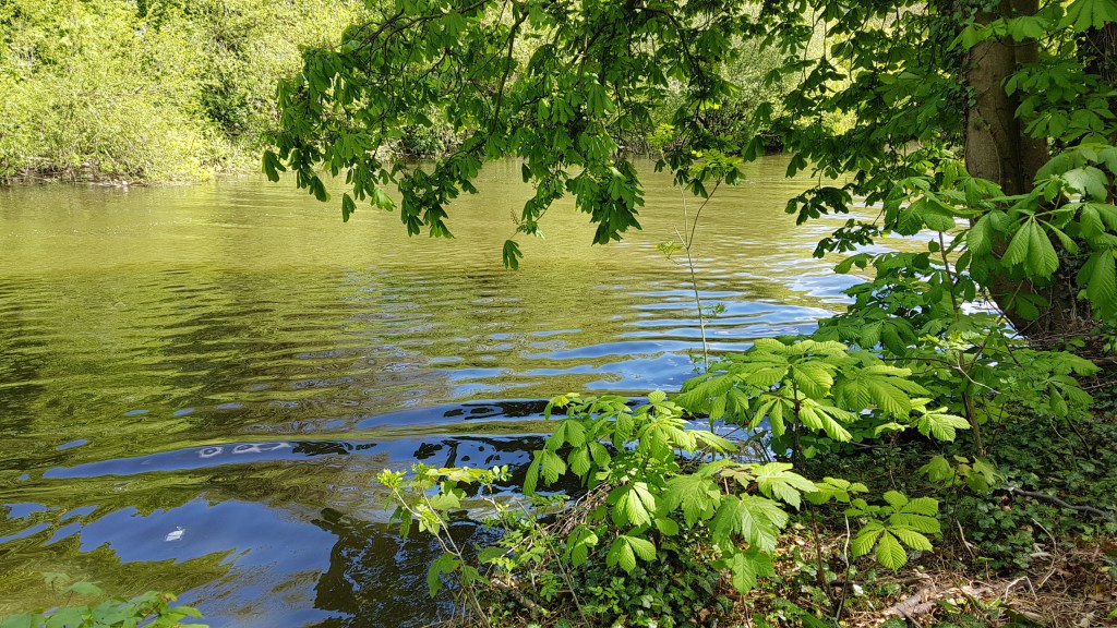
Pretty river
The walk continues into a quieter phase. The countryside wraps around you, the noise of the traffic departs, and all you hear are the sounds of birds and the odd boat puttering by. On the path you mostly meet dog walkers and the odd backpackers.
Walking into Old Windsor one might think that you are near the royal town with the castle. You are some miles away from all that!
Not a castle in sight, just glassy water
So good to know I am on the right path!
Perhaps my favourite photo of the walk – Old WindsorOld Windsor Lock
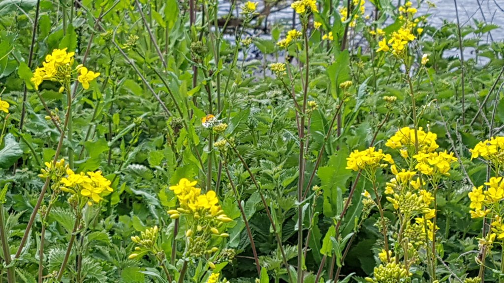
Not too far after Old Winsor Lock I came to Albert Bridge which I had to cross for the last leg of this walk. This was by far the most beautiful part of the walk. Again the countryside hummed around me. Lots of trees and wild plants. Many Orange-tip butterflies flitted around me as well as buzzing bees. The scenery was wild and it made me feel wonderful just to be here.
Albert BridgeCan you see the Orange-tip butterfly?
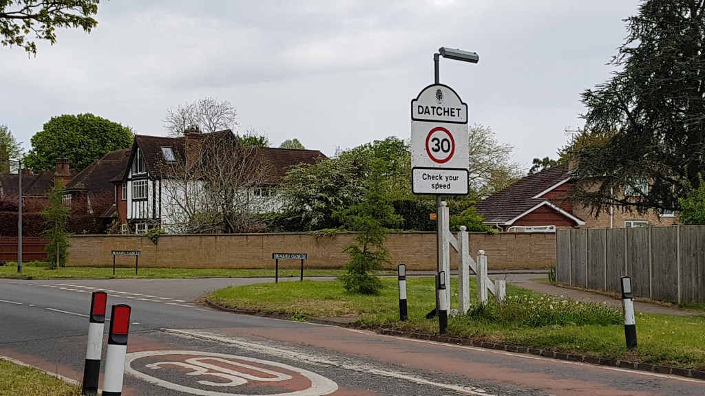
After a while, the path veered right and ran alongside farmland towards the road, though the path was fenced. I was nearly at my journey’s end and soon came across the sign for Datchet.
By now I was desperate for a cup of tea and wondered what Datchet would offer. Firstly, I had to find the Thames again, just to mark my stopping point.
And here we are – the stretch of Thames at DatchetFirst glimpse of Datchet
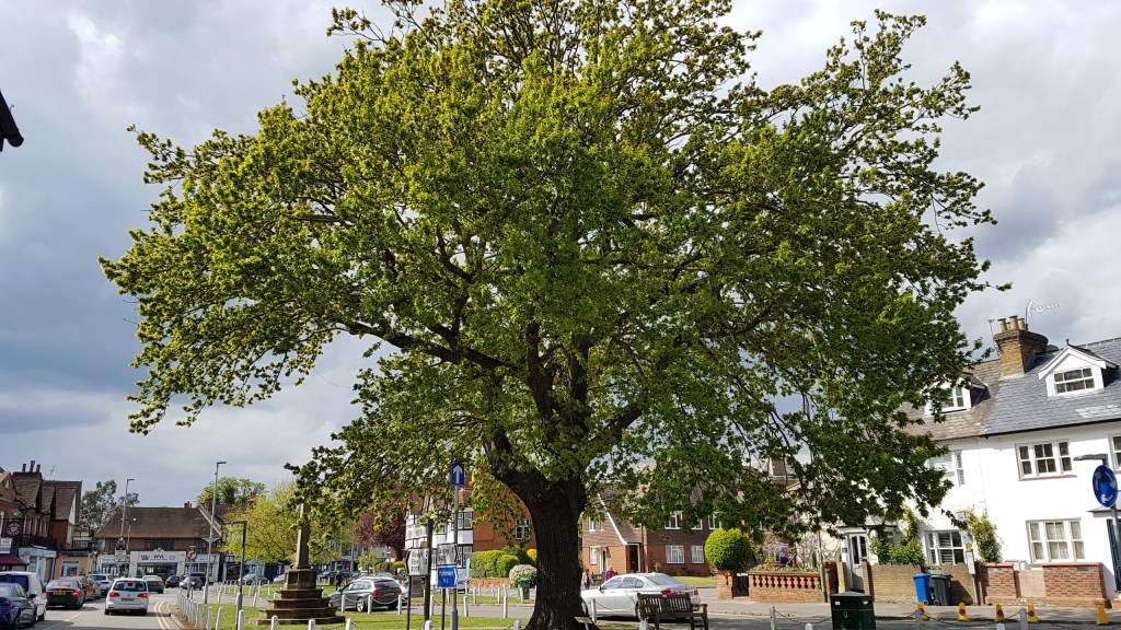
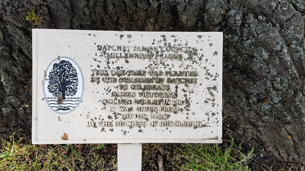
Datchet is a pretty village with a green and a very old tree. It was planted to celebrate Queen Victoria’s Golden Jubilee in 1887. That is where I sat (under the tree) to drink my cup of tea. I did not expect to find a Costa in Datchet, but I was so grateful as there was nothing else open. The train station was close by and it was time now to head home. It had been a wonderful walk.
It was business as usual this week. The heatwave has subsided and we had to contend with rain instead. So. choosing the right day for a walk was important. Luckily we chose the best!
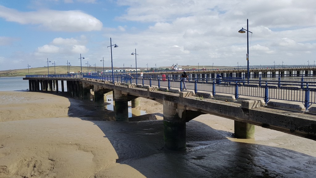
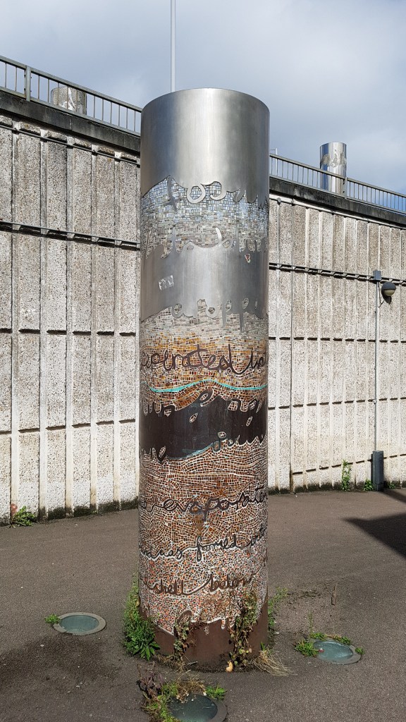
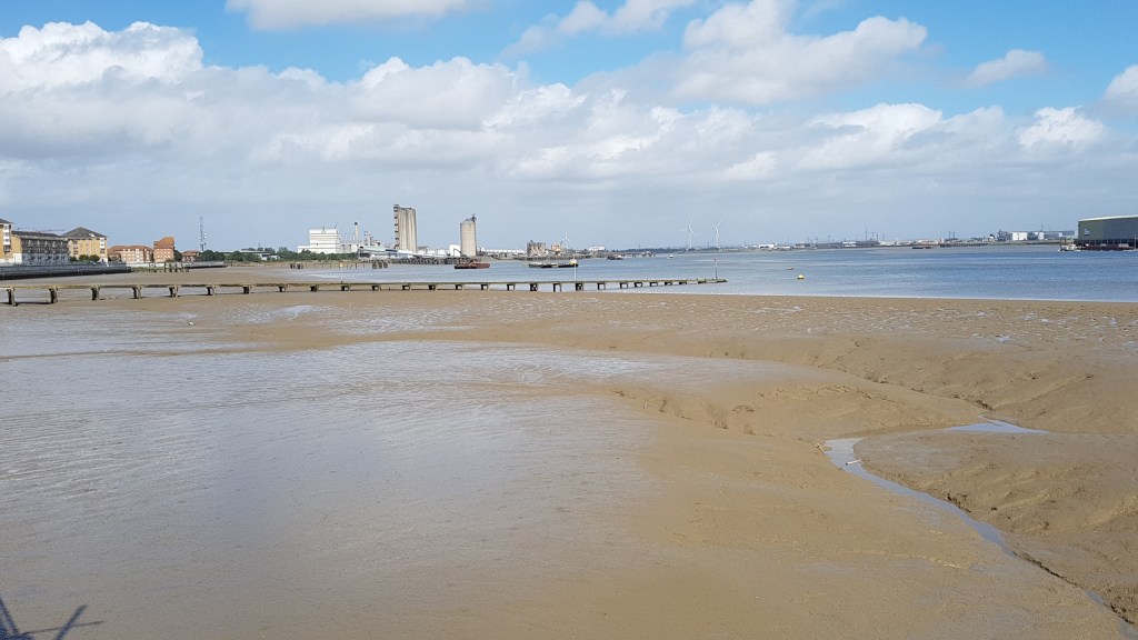
Believe it or not, this is still classed as London! You can catch a train from Charing Cross to get here (about 40 minutes on the stopping train). Erith has a town with shopping centre, but you need to cross a very busy road to get there and to the river – there is a public underpass with a couple of neat art instalations about the river. The walk itself is a short one, at a guess, about three miles or so. It was an ambling day!
Erith pedestrian underpass
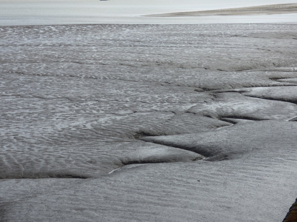
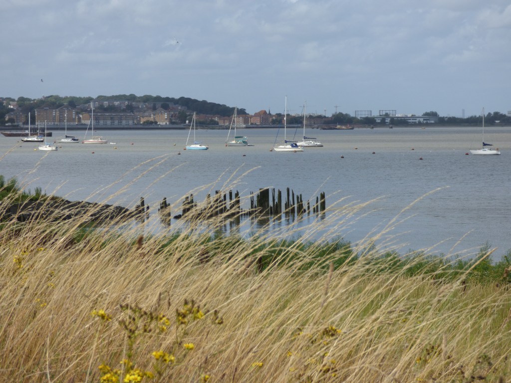
We walked along the pier and I was fascinated by the ripples in the sand. We then doubled back. To the left is the Thames Path leading into London. Last time we were here in Erith we walked that way as far as Woolwich. At Erith you cannot see the tall towers of London, but across the river is Essex and Rainham Marshes. However, today we were heading right.
Looking towards London
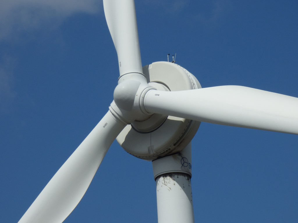
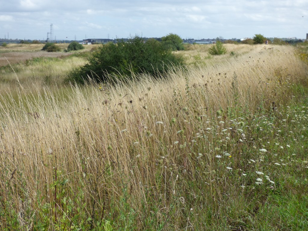
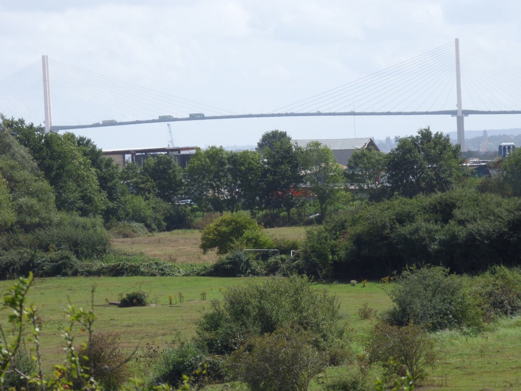
The first section we walked was mainly off river. We had to leave the quiet behind and cope with the noisy road with an industrial estate on our left. Then finally we found the path leading back down to the river. Here was a wind turbine. They always fasccinate me and you could hear it as whirled around. This section is lovely as you come out into the wild. In the distance we could see the Queen Elizabeth II Bridge at Dartford. This crosses the river and you get good views of it. On either side of the path is scrub with bushes and grass, lots of grasshoppers and butterflies. We found an old railway sleeper to sit on and eat our lunch. There were harldy any people about.
This is where we stopped for lunch
Walking further around we did encounter another industrial estate on our right but at least we had the river on our left. We approached the leaving point of the river Thames where at Crayford Ness you meet the River Darent running into the Thames. Here we followed the Darent (there is nowhere to cross it for this is the end of the Thames Path Extension) and found Dartford Creek Barrier which is used for high tides (possibly in conjunction with the Thames Barrier). More on the River Darent can be found here.
The Dartford Crossing – Queen Elizabeth II Bridge
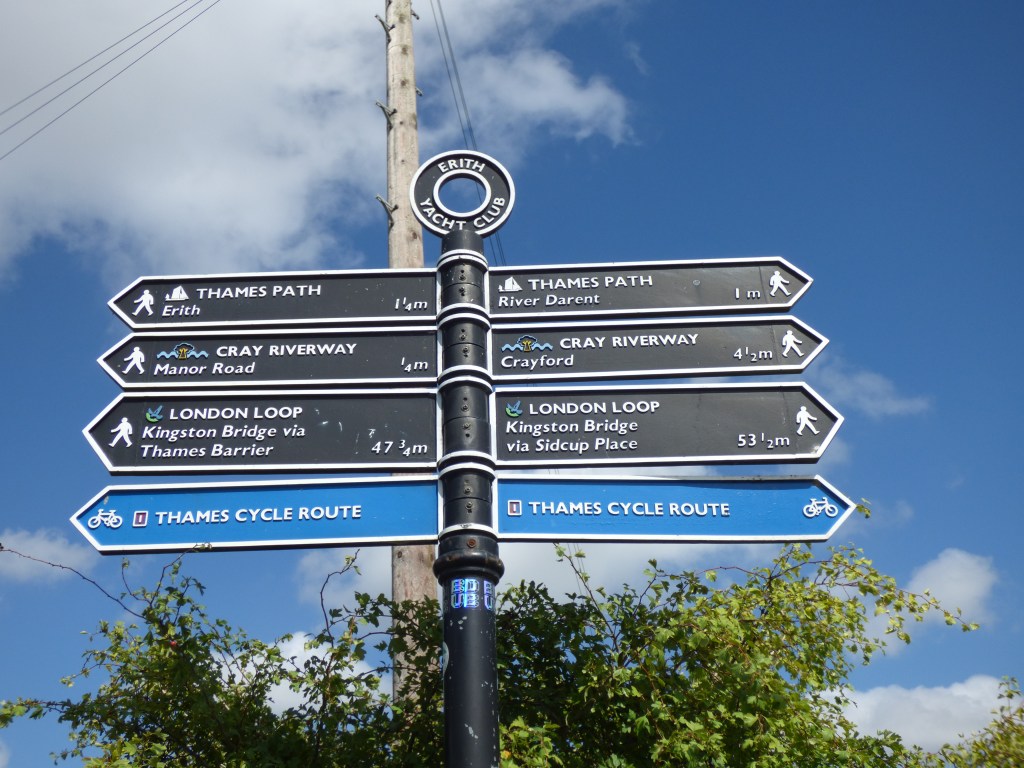
We followed the river until we came to another path. We needed to get to Slade Green Ststion and thought we knew which path we needed, but there were was no signage. Before I could consult the book another walker came along and he confirmed the path we needed was the one we thought. The other path (he was taking) was part of the London Loop which goes around all over London.
Dartford Creek Barrier – River Darent
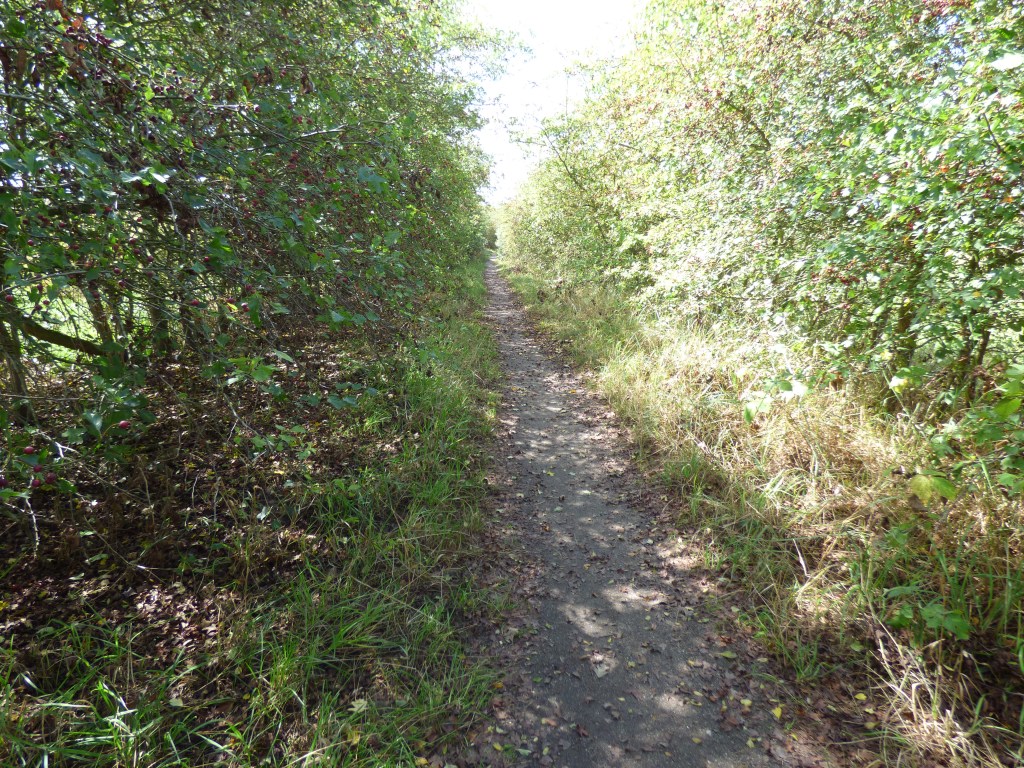
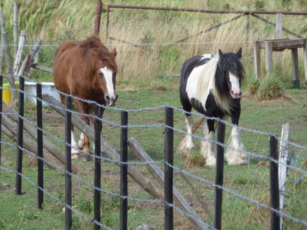
The walk back to Slade Green Station was lovely. Trees overhung almost forming a tunnel. It was a nice respite from the hot sun. On our left and right were fields with horses. Then the best find of the day. Over in one field where two horses roamed I could see what looked like a moat! I consulted the Thames Path Book which informed me that what we were looking at was indeed a moat. This is Howbury Moat, formerly part of a Manor which dates back to the 11th century when Odo, Bishop of Bayeux lived there. He was the half brother of William the Conqueror!
The path to Slade Green StationHowbury Moat, mentioned in the Doomsday Book
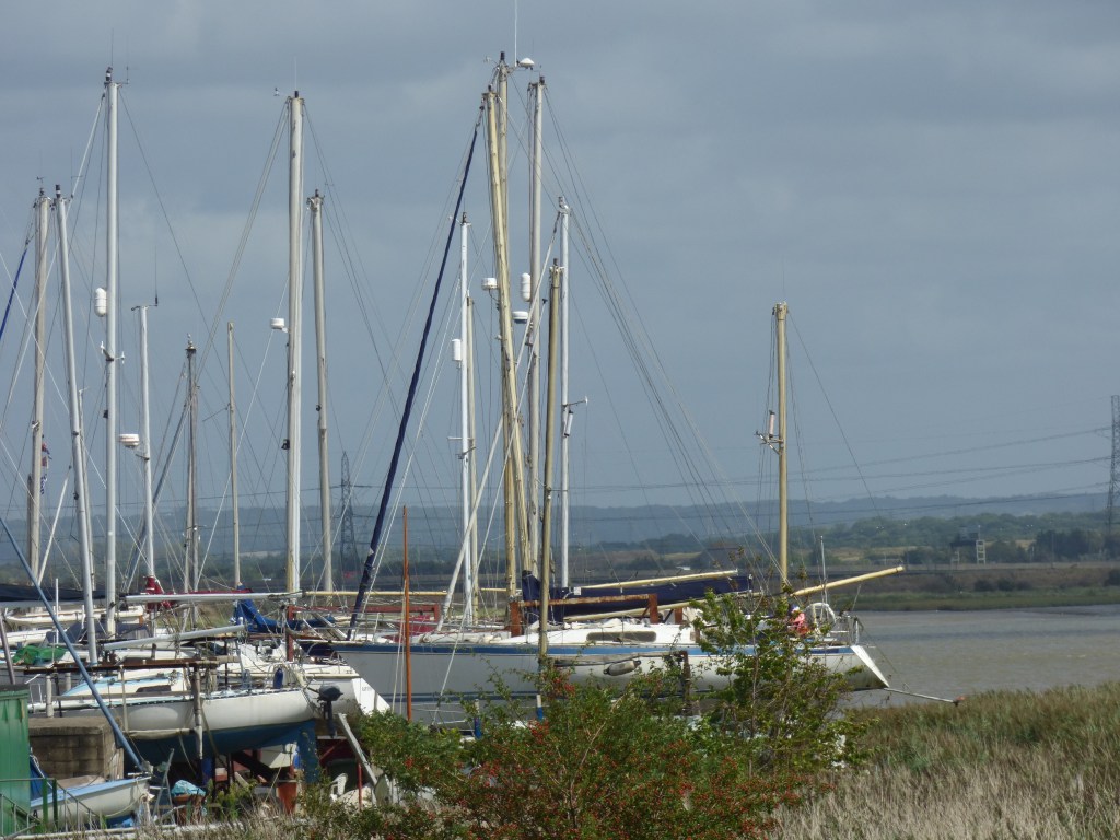
From there it was just a short walk to the station and the train back into London. I have walked many stretches of the Thames Path over the last few years. Put together I’ve walked from Staines (Middlesex), through the whole of London to where the Thames path ends at Crayford Ness. This section was perhaps the shortest part I’ve walked, but it was lovely all the same.
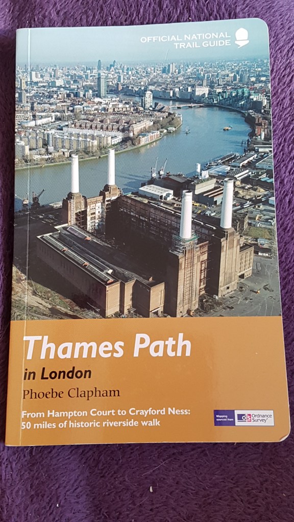
This excellent guide has travelled with me on the routes. This one I have now completed and have edged into the the one from the source to Hamtopton Court!